Move® Software
Petroleum Experts (Ltd) Provides Move® Software Suite for Use in Research and Teaching
Petroleum Experts (Ltd) (http://www.petex.com/ ) a recognized global standard in petroleum engineering and structural geology software tools continues to support the research and teaching mission of the Geosciences and Geological and Petroleum Engineering department at Missouri S&T. Petroleum Experts (Ltd) is providing 10 one year licenses of both the Move® and IPM® software suites (http://www.petex.com/products/move-suite/ and https://www.petex.com/products/ipm-suite/ respectively). These software packages are the industry-recognized standards and are valued at a combined total of $5,002,502.52.
The IPM suite is the standard across the worldwide oil and gas industry and is currently used by more than 350 oil and gas companies. The Petex IPM software allows for the modeling of full oil and gas production systems by capturing the physics, geology, engineering and fluid thermodynamics of the system from reservoir to oil and gas wells to the surface pipeline system and process. Once built, these models are used to optimize production for existing oil and gas fields and to assist with the system design of new fields.
The Petex software will be used by approximately 100 petroleum engineering students at Missouri S&T in courses and for research purposes. S&T students will have access to the full Integrated Production Modeling suite, which consists of the following:
- PVTP, which predicts the effect of process conditions on the composition of hydrocarbon mixtures and fluid characterization
- MBAL, an analytical reservoir tool commonly used for modeling the fluid dynamic reservoir effects and material balance.
- REVEAL, which is designed to study specialized reservoir effects and assess their impact on the injection, production and enhanced oil recovery from the reservoir, capturing the thermal, rock mechanics and chemistry.
- PROSPER, a design and optimization program for modeling most types of oil and gas well configurations.
- GAP, a multiphase oil and gas optimizer that models the surface gathering pipeline network of field production systems. GAP integrates dynamically the reservoir model (MBAL) and well models (PROSPER).
- RESOLVE, a field engineering development tool that manages and controls the IPM suite, Reservoir Simulators, Process Simulators to dynamically model, optimize and provide production forecasts of field operating scenarios. RESOLVE enables coupling of most major industry reservoirs, processes, and economics simulation models to better evaluate and operate oil and gas fields.
Daniel Quick, a Ph.D. candidate, is our resident expert for The Move® suite. The Move® suite is one of the most powerful and complete software packages for analysis and modeling of complex geologic structures. The ten different software toolkits that comprise the Move® suite allow for 2D and 3D kinematic modeling of geologic structures, including Geomechanical Modelling, Fracture Modelling, Stress Analysis, Fault Analysis, and Fault Response Modelling. In addition, communication packages that allow Move® to work with Petrel, Open works, and Link GST are also being provided and may be used in course work in Petroleum Geology.
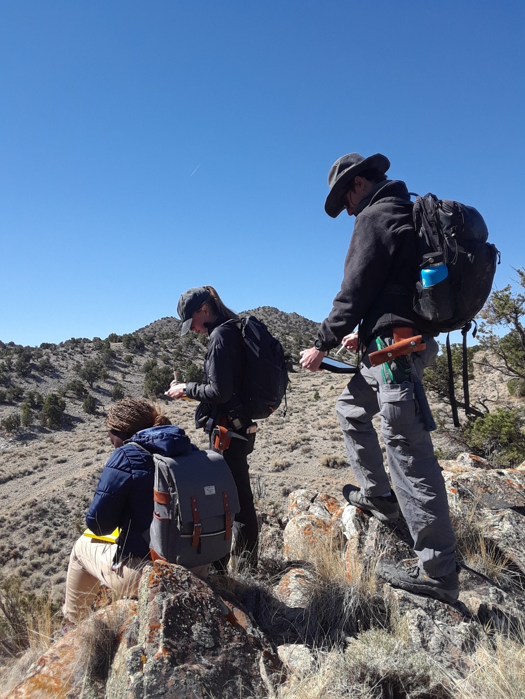
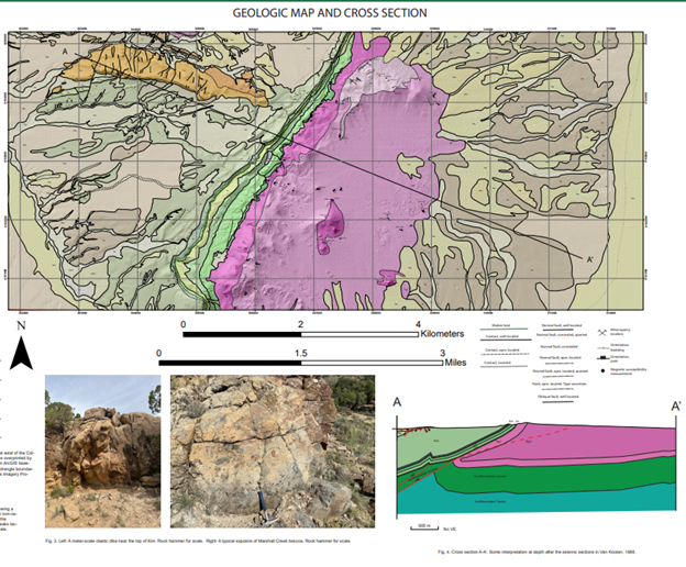
Daniel has presented the results of his geologic mapping, partially funded by the USGS EdMap program, at two national Geological Society of America meetings (Quick et al., 2022, 2023). He is working on role of magmatic flare-ups, episodic deformation, and clastic deposition during the Sevier Orogeny. We have mapped a portion of the southern half of the Three Peaks 7.5’ Quadrangle near Cedar City in southwest Utah. We have been able to constrain the timing of emergence of the Iron Springs thrust to ~100 Ma which was considerably earlier than previously thought (Quick et al., 2020; 2023a, b). Since then, we have completed a more detailed geologic map and cross-section of this area using a combination of remote sensing techniques and “boots-on-the-ground” field mapping (Quick and Hogan, 2022, Quick et al., 2023a,b). Daniel used Move® to prepare the cross-section for this geologic map. This proved critical in identifying one of several previously unrecognized faults in the area. He presented his work at the national Geological Society of America meeting as a poster in 2022 and 2023 (see below) and a previous version at a virtual conference sponsored by the Missouri Geological Survey in 2022. A portion of his poster presentation, including the cross-section constructed with Move® is included below. A full version of the poster can be seen here [link to scholar’s Mine Needed]. We are in the process of preparing additional manuscripts for publication on the geology of this area in which we will use MOVE® to assist with construction of the geologic cross-sections.
References and Publications that used and acknowledged Move®
Quick, J.D., Hogan, J.P., and M. Wizevich, 2023a, Detailed geologic map of the southern portion of The Three Peaks Quadrangle, Iron County, Utah, USA: A record of Sevier orogenesis, iron-oxide-apatite mineralization, and Basin and Range extension. Geological Society of America Abstracts with Programs. Vol. 55, No. 6, 2023 doi: 10. 1130/abs/2023AM-394891 https://gsa.confex.com/gsa/2023AM/webprogram/Paper394891.html
Quick, J.D., Hogan, J.P., and M. Wizevich, 2023b, Depositional history of the Albian to Cenomanian lower Iron Springs Formation: Implications for episodic advancement of the Sevier fold-thrust belt in southwest Utah. Geological Society of America Abstracts with Programs. Vol. 55, No. 6, 2023 doi: 10. 1130/abs/2023AM-394994 https://gsa.confex.com/gsa/2023AM/webprogram/Paper394994.html
J. Daniel Quick, John P. Hogan, 2022, Practical remote sensing data analysis for efficient geological field mapping: An example from the southwest portion of the Three Peaks 7.5ʹ quadrangle, southwest Utah.Rocky Mountain Geology; 57 (2): 117–135. doi:https://doi.org/10.24872/rmgjournal.57.2.117
Quick, J.D., Hogan, J.P., Wizevich, M., Coleman, D.S., 2021, Punctuated orogenic activity: Evidence for a 100 Ma Episode of Sevier Deformation in southwest Utah. Geological Society of America Abstracts with Programs. Vol 53, No. 6, 2021 doi: 10.1130/abs/2021AM-368404
Quick, J.D., and Hogan, J.P., 2021, Preliminary results of geologic mapping of the southern portion of the Three Peaks 7.5’ quadrangle, Iron County, Utah, Geological Society of America Abstracts with Programs. Vol 53, No. 6, doi: 10.1130/abs/2021AM-368427.
J. Daniel Quick, John P. Hogan, Michael Wizevich, Jonathan Obrist-Farner, James L. Crowley, 2020, Timing of deformation along the Iron Springs thrust, southern Sevier fold-and-thrust belt, Utah: Evidence for an extensive thrusting event in the mid-Cretaceous. Rocky Mountain Geology; 55 (2): 75–89. doi: https://doi.org/10.24872/rmgjournal.55.2.75
Follow Geosciences and Geological and Petroleum Engineering